Samar
Is Samar dangerous? What I actually found
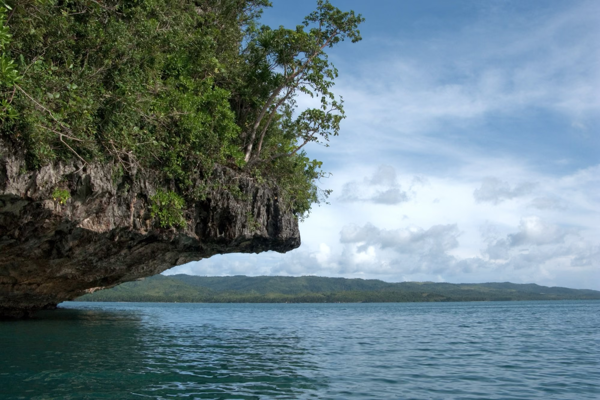
Photo: Vyacheslav Argenberg, CC BY 4.0, via Wikimedia Commons.
Short answer: none of the three governments checked below tells travellers to stay away from Samar as a whole, but the US advisory does name its rural and remote areas because of insurgent activity. The practical risks a visitor is most likely to meet are typhoons, flooding and road closures, set out with sources further down.
On my own trip through Samar, in September 2026, I ran into no trouble; the US State Department’s current advisory does name rural and remote areas of Samar, and what the US, UK and Australian governments say is set out with dates under Current safety advice below. Before I went to Samar, people kept telling me the same thing: don’t go, it’s dangerous, there’s criminality, there are rebels, there’s voodoo. I had heard all of it, and none of it from anyone who had actually been. So I went to see the real Samar for myself.
Current safety advice
This is what three governments say, checked on 17 October 2026. Read the current version before you book.
- United States, State Department (advisory dated 1 September 2026). The Philippines as a whole is at Level 2, “exercise increased caution”. The advisory names rural and remote areas of Samar, together with Leyte, Mindoro and Negros, because of insurgent activity (travel.state.gov).
- United Kingdom, FCDO (updated 15 July 2026). Samar is not in the FCDO’s list of areas it advises against travelling to. That list covers Mindanao and the Sulu archipelago (gov.uk).
- Australia, Smartraveller (updated 24 September 2026). “Exercise a high degree of caution” in the Philippines overall, due to the threat of terrorism and violent crime. Samar is not named in its higher warning levels, which cover parts of Mindanao and the Sulu area (smartraveller.gov.au).
What people told me before I went
The warnings were always vague, “dangerous,” “remote,” “stay away”, but never backed up with something that had actually happened to the person saying it. That is often how a place gets a reputation: secondhand, not firsthand.
The thing people actually mean: the NPA
When people say Samar is dangerous, what they usually mean is the New People’s Army, the armed wing of the Communist Party, active in several mountain provinces across the Philippines including parts of Samar. On the bus there, I talked about this with the people travelling with me. What they told me: the NPA is based in the mountains, and is not known for targeting local people or foreigners, their stated fight is with the government over corruption, not with travellers.
This is what I was told by the people I travelled with, and what I experienced myself: a long bus ride, a ferry, small towns, rice fields, and nothing that felt remotely threatening. It is not a safety guarantee. If you are planning a trip, check your own government’s current travel advisory for the Philippines and Samar specifically, the same way you would for any province.
Getting there: a very long bus ride
I flew into Manila, then took a long-distance bus to Samar, around 14 to 16 hours depending on stops, overnight, with aircon. After that, a short ferry crossing to the island itself, which cost a small amount per person on my trip. Check current bus and ferry options before you go, for example through 12Go.
Along the way: a roadside stop for grilled chicken, a flat tyre that cost the bus some time, and the kind of small-town normal life you do not see from an airport.
What I actually found
Once we reached the west side of the island, we hiked up to one of the biggest waterfalls I have seen on the island, steep enough that I was out of breath getting there, with coconut trees forty metres tall around it and local guys who climb them barehanded to harvest coconuts for a living. That, more than anything, is what Samar actually looks like day to day: ordinary people working hard in a place most tourists skip.
I also passed through Catarman, which locals call the “school capital” of Samar because of how many students come there to study, and ate at a Mang Inasal, the fast-food chain you will find in nearly every Philippine town, Samar included.
Checked externally: the advisory and the typhoon season
Here is what the official sources say, checked on 15 October 2026, next to what I was told and saw.
The advisory. The US, UK and Australian advice, with dates, is under Current safety advice above. The US expansion in September 2026 to name rural and remote areas of Samar was also reported by BusinessMirror, 4 September 2026. What the people I travelled with told me is that it is a mountain-province issue, not something aimed at the towns, roads and ferries a visitor actually uses. Check your own government’s current advisory before you book.
The typhoon season. Samar’s typhoon season runs roughly June to November and peaks July to October. Unlike the west side of the Philippines, the east coast of Samar and Leyte also picks up a second wet season in November and December from the Amihan wind, so there is no clean dry season here the way there is in, say, Boracay (Wego Travel Blog; Pana.ph, both checked 15 October 2026). February to May is the clearest window. On my own bus ride, in September, there was a tropical depression building off the east coast, nothing that stopped us, but a reminder that this is typhoon country whatever month you go.
Practical risks: roads, floods and the bridge to Leyte
These are the risks with a public record behind them, separate from the rebel reputation. Checked on 19 October 2026.
- Flooded roads. On 23 December 2024, the Department of Public Works and Highways’ regional office reported several road sections in the Samar provinces closed by flooding after days of rain, including stretches in Catubig and Las Navas on the Arteche–Jipapad–Las Navas–Rawis road between Eastern and Northern Samar, impassable to all vehicles (Manila Times, 25 December 2024).
- Landslides. In November 2017, heavy rain from Tropical Storm Salome set off landslides and rockslides that blocked major roads between Samar and Northern Samar at four sites around Calbayog and San Isidro; DPWH aimed to clear them within 24 hours (PTV News, 10 November 2017).
- San Juanico Bridge. The bridge links Samar with Leyte and Tacloban. DPWH Eastern Visayas ran a dry run on 10 December 2025 for a 15-ton load limit, due to take effect on 12 December 2025 (DZRH, 10 December 2025). If your route goes via Tacloban, ask your bus operator how it crosses.
Where to check before you travel: PAGASA for tropical cyclone bulletins, and DPWH’s regional announcements for road closures.
So, is it dangerous?
Based on my own trip: no trouble, no tension, and a welcome that was, if anything, warmer than in more touristy parts of the country. The rebel-group reputation is real in the sense that the NPA exists in the region, but from what I was told and what I saw, it is not something aimed at visitors travelling the normal routes. Use the same common sense you would anywhere, stay on known routes, keep an eye on the news, check your government’s travel advisory, and the “dangerous island” label says more about how little people know about Samar than about what is actually there.
Watch the full video on my channel
If caves are more your thing than a bus ride and a waterfall, I also wrote up a night inside the Langun-Gobingob cave system on the same island, which starts with a briefing in Catbalogan the day before. Both are part of the optional cave days in the small-group trip to Samar I am planning, the waitlist is free.
Samar is not the only place here that gets written off before anyone goes. Limasawa in Southern Leyte and the Dinagat Islands are the two other places I have been where I met almost no other travellers.
Questions people ask
Is Samar dangerous for tourists?
In my own time there I did not run into any trouble. The reputation comes mostly from the NPA, a rebel group based in the mountain provinces. The people I travelled with told me the NPA is not known for targeting local people or foreigners. That is what I was told and saw, not a safety guarantee. Check your own government's travel advice before you book.
What is the NPA, and does it affect visiting Samar?
The New People's Army, the armed wing of the Communist Party. See The thing people actually mean: the NPA above for what the people I travelled with told me, and why I stayed on the normal travel routes.
How do you get from Manila to Samar?
I took a long-distance bus from Manila, around 14 to 16 hours depending on stops, then a short ferry crossing. That was my trip in September 2026. Check current buses and schedules, for example on 12Go, before you travel.
What does the official travel advisory say about Samar?
Checked on 17 October 2026: the US State Department's advisory, dated 1 September 2026, keeps the Philippines at Level 2, 'exercise increased caution', and names rural and remote areas of Samar, Leyte, Mindoro and Negros because of insurgent activity. The UK FCDO (updated 15 July 2026) and Australia's Smartraveller (updated 24 September 2026) do not name Samar in their warnings. Check your own government's current advisory before you book.
Is Samar in typhoon season risk?
Yes. Samar's typhoon season runs roughly June to November and peaks July to October, and the east coast also gets a second wet season in November and December from the Amihan wind. There is no clean dry season here the way there is on the west side of the country. February to May is the clearest window (checked 15 October 2026).
Is it safe to travel by road in Samar?
The main risk on Samar's roads is the weather. Heavy rain has closed road sections before: DPWH reported sections in Northern Samar impassable to all vehicles after flooding in December 2024, and Tropical Storm Salome caused landslides on roads near Calbayog in 2017. Check PAGASA weather bulletins and local road advisories before a long road trip, especially from June to December. Checked 19 October 2026.
Can you cross the San Juanico Bridge between Samar and Leyte?
Yes, with a 15-ton load limit. DPWH Eastern Visayas held a dry run on 10 December 2025 for the limit, set to take effect on 12 December 2025. If your bus route goes via Tacloban, ask your operator how it crosses.
One email when there is a new guide
I write when there is a new guide, and only then.